


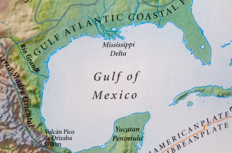
Washington, D.C.— The National Oceanic and Atmospheric Administration (NOAA)reported that the latest dead zone in the Gulf of Mexico measures 8,776 square miles, about an area the size of New Jersey, making it the largest dead zone since mapping began in 1985. A dead zone is a an area of low oxygen in the water that can kill fish and other marine life, like aquatic plants. The cause of dead zones in the Gulf of Mexico are the cause of nutrient pollution as a result of runoff from agriculture and developed land in the Mississippi River watershed. These nutrients such as nitrogen, used to fertilize soil, stimulate massive algal growth on the surface of water, that eventually decomposes, using up the oxygen needed to support marine animals and the plant life that serves at their habitats.
Researchers say that the chronic dead zones, which occur annually, averaging in size at 5,806 square miles, will cause a reduction in coastal fish populations, as well as the slowing of shrimp growth, leading to fewer large shrimp. Specifically, scientists used anindividual-based population model, measuring the abundance of Atlantic croaker and determined that the dead zones would lead to a 25% reduction in long term population abundance of Atlantic croaker over a 140 year period. The dead zones are likely to affect the abundance of other coastal fish populations as well.
The current dead zone exceeded NOAA’s original forecast of 8,185 square miles. “Having a long-term record of the size of the Gulf of Mexico dead zone is vital in forecasting its size, trends and effects each year,” said Steven Thur, Ph.D., acting director of NOAA’s National Centers for Coastal Ocean Science in the report. “These measurements ultimately inform the best strategies for managers to reduce both its size and its impacts on the sustainability and productivity of our coastal living resources and economy.”


Ashwagandha Enters a Root-Only Era in India
June 30, 2026

